

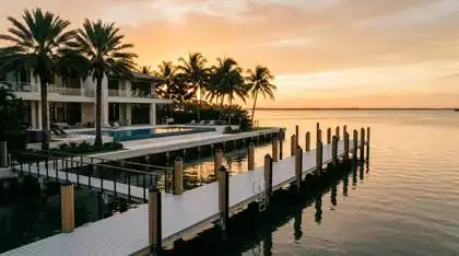
Air draft, bridge clearances, dredge depths, seawall responsibility, and dock permitting for Miami waterfront buyers. A technical guide from The Audrey Ross Team at Compass Florida.
The Short Answer
No-bridge dockage means no fixed span sits between a dock and open water, so nothing caps a boat’s air draft. In Miami it is found on bayfront and outer-canal lots in Gables Estates, Cocoplum, Tahiti Beach, Old Cutler Bay and Coconut Grove. Inland Coral Gables Waterway lots sit behind eighteen bridges the City publishes at 7 to 21 feet.
Waterfront listings in Miami use two phrases almost interchangeably: deep water and no fixed bridges. They describe entirely different constraints, they are governed by different agencies, and in our experience confusing them is the costliest avoidable mistake a boating buyer makes here. One is a ceiling. The other is a floor. A property can have a magnificent, unobstructed run to Biscayne Bay and still be unable to float your boat at low tide.
Our firm has sold the southern Coral Gables waterfront since 1984, more than 40 years in the same guard-gated enclaves, through every dredge cycle, seawall replacement and permitting regime change in that period. This guide is the technical brief we give clients before they tour a single waterfront property, written to be read with a chart open.
What does no fixed bridges actually mean?
A fixed bridge is a permanent span that does not open. Its published vertical clearance is an absolute ceiling on every vessel that passes beneath it, forever. A bascule bridge, drawbridge or swing bridge opens on a schedule or on request, so it does not cap height. It costs you time, radio work and occasionally an inconvenient wait, but not access.
When a Miami listing says no fixed bridges, it is asserting that a boat of any height can leave that dock and reach the ocean. That single characteristic is why bayfront and outer-canal parcels trade at a premium against otherwise comparable inland waterway lots. It cannot be engineered onto a property later. Either the route is clear or it is not.
What is air draft, and why does it decide the answer?
Air draft is the vertical distance from the waterline to the highest fixed point on a vessel. Buyers routinely underestimate it because they measure the wrong thing. A boat’s air draft includes the hardtop, the radar arch, the tuna tower, the satellite dome, the VHF and AIS antennas, the outriggers in their stowed position, and on a sailboat the masthead instruments and windex above the masthead light.
Sailboats are the clearest case. A cruising sailboat in the 40 to 55 foot range commonly carries a mast tall enough that no realistic fixed bridge in the Coral Gables system is passable, which is why sailboat owners in this market shop almost exclusively for bayfront or outer-canal positions. Motor yachts vary far more. A flybridge sportfisherman with a tower can carry more air draft than a much larger express cruiser with a folding hardtop. Measure your specific boat, with the equipment you actually intend to run, and add a margin.
Does the tide change a bridge’s published clearance?
Every published bridge clearance is measured against a reference water level, not against the water in front of you right now. On federal nautical charts that datum is typically mean high water for vertical clearance, which means real clearance is greater than the published figure at low tide and less than it at high tide. On a seasonal king tide or a strong onshore wind event, real clearance can drop meaningfully below the number on the sign.
Two practical consequences. First, a bridge that is comfortably passable in the morning may not be at dinner. Second, if your air draft is within a foot or two of a published clearance, you do not own reliable access. You own a tide-dependent option, and you will plan your life around a tide table.
Which Miami communities have true no-bridge ocean access?
The honest answer is that bridge status is a lot-level fact, not a community-level one. Several of the enclaves marketed as no-bridge contain both bayfront parcels with a genuinely unobstructed run and inland parcels that sit behind a published span. This is where the most consequential due diligence on a Miami waterfront purchase happens, and it takes about twenty minutes with a chart.
What are the published Coral Gables Waterway bridge clearances?
The City of Coral Gables publishes vertical clearances for the eighteen bridges across its waterway system. It is the reference we hand clients first, and it is consulted far less often than it should be. Sorted from lowest to highest:
| Bridge | Published clearance | What that ceiling means in practice |
|---|---|---|
| Pisano Avenue | 7 ft | Small open boats only. Excludes most hardtops. |
| Prado Boulevard | 7 ft | Small open boats only. Excludes most hardtops. |
| Bird Road | 7.5 ft | Center consoles with folding T-tops, tenders, small runabouts. |
| Blue Road (East) | 7.5 ft | Center consoles with folding T-tops, tenders, small runabouts. |
| Blue Road (West) | 7.5 ft | Center consoles with folding T-tops, tenders, small runabouts. |
| Ponce de Leon Boulevard | 7.5 ft | Center consoles with folding T-tops, tenders, small runabouts. |
| Granada Boulevard | 8 ft | Excludes any fixed hardtop above 8 feet. |
| US-1 (South Dixie Highway) | 8 ft | Excludes any fixed hardtop above 8 feet. |
| Alhambra Circle | 9.5 ft | Some fixed-hardtop center consoles clear; verify per boat. |
| Lugo Avenue | 9.5 ft | Some fixed-hardtop center consoles clear; verify per boat. |
| Cocoplum Boulevard | 12 ft | Many hardtop boats clear; excludes towers and arches above 12 feet. |
| Old Cutler Road | 15 ft | Passable for most hardtop and many flybridge boats. |
| Matheson Hammock / Hammock Oaks | 16 ft | Passable for most hardtop and many flybridge boats. |
| Maynada Street | 16 ft | Passable for most hardtop and many flybridge boats. |
| Granada (Mahi) | 18 ft | The highest tier in the system. Still excludes any mast. |
| Hardee Road | 18 ft | The highest tier in the system. Still excludes any mast. |
| LeJeune Road | 18 ft | The highest tier in the system. Still excludes any mast. |
| Isla Dorada Boulevard | 21 ft | Highest published clearance in the system. Still excludes any mast. |
Clearances as published by the City of Coral Gables Public Works Department, Right of Way Maintenance and Enforcement Division, Waterways and Mangroves. Retrieved July 2026. The third column is our plain-language reading of the published figure, not a City statement.
Which parcels actually have an unobstructed run to the bay?
The parcels that genuinely deliver unobstructed access are the ones that reach Biscayne Bay without passing under anything on the list above. In practice that concentrates in the bayfront and outer-canal positions of Gables Estates, Cocoplum, Tahiti Beach and Old Cutler Bay, together with bayfront and canal homes in Coconut Grove and on Key Biscayne.
One naming trap is worth flagging before you tour, because it catches buyers and it catches search engines. The Coast Pilot describes Snapper Creek Canal, about 1.3 miles south of Matheson Hammock, as a drainage canal navigable to a salinity structure roughly 1.3 miles above the entrance, with a yacht basin just upstream of the highway bridge a mile above the entrance. That fixed bridge has a 20-foot span with a clearance of 11 feet, and the canal entrance had a reported controlling depth of 5 feet in 1999. Snapper Creek Canal and the residential enclave of Snapper Creek Lakes are not the same body of water, and a figure that belongs to one should never be quoted for the other.
Community-level dock rules are the second thing to check. Some sections within these enclaves govern dock configuration through their own recorded dock plans, at a level of detail neither the County nor the City imposes, which means a design that is approvable by both the county and the city can still fail privately.
How do you get from Biscayne Bay to the ocean?
No-bridge access to the bay is only half the route, and this is where listing language almost always stops. From the southern Coral Gables shoreline there are two practical ways out. Running east and south, Biscayne Channel leads through the shoals south of Cape Florida into Biscayne Bay. The federal Coast Pilot describes it as partially dredged but shoaled, marked by lights and daybeacons, and cautions that craft whose draft is close to the limiting depth of the channel should exercise extreme caution in navigating it. Cape Florida Anchorage, about 300 yards westward of the south end of Cape Florida, is charted at depths of 12 to 20 feet, and the Coast Pilot calls it a poor anchorage in southerly winds.
Running north, Miami South Channel is a dredged cut leading from Biscayne Bay, westward of Virginia Key, to the Miami waterfront. One branch leads into the Miami River and the other leads directly to the basin off Bayfront Park. The Intracoastal Waterway route southward to Key West passes through it.
The detail that changes the answer for a tall rig
Here is the fact that rarely appears in a listing, and it is the most useful thing on this page for a sailboat owner: the northern route is not air-draft-free. The Coast Pilot places the Rickenbacker Causeway at Intracoastal Waterway Mile 1091.6 and describes a fixed span over the waterway with a clearance of 76 feet. On the Key Biscayne side, the highway bridge over Bear Cut carries a 48-foot fixed span with a clearance of 16 feet.
Read those two numbers together and the practical picture resolves. A sportfisherman or motor yacht leaving a genuinely no-bridge southern Coral Gables dock has an unobstructed run in every sense that matters, in either direction. A sailing yacht with a tall rig has one usable ocean exit rather than two, because the eastbound run through Biscayne Channel is open overhead while the northbound Intracoastal run has a 76-foot ceiling at the Rickenbacker Causeway. That distinction is invisible in the phrase no fixed bridges, and it is precisely the kind of detail that separates a dock that fits your boat from a dock that fits the marketing.
Source: NOAA U.S. Coast Pilot 4, chapters 11 and 12, 26 July 2026 edition. Retrieved July 2026. Coast Pilot descriptions are not a substitute for the current chart and the Local Notice to Mariners, and reported clearances and depths change.
Verify the route, not the listing language
No fixed bridges is a marketing phrase with no regulatory definition and no enforcement behind it. Before you write an offer on a boating property, trace the full route from that specific dock to open water on the current NOAA chart, identify every span crossed, confirm each published clearance and its datum with the City, and measure your vessel’s true air draft with the equipment you plan to run. We do this as a standard part of waterfront due diligence, and it changes the answer more often than buyers expect.
How deep is deep water, and who decides?
There is no legal definition of deep water in a Florida real estate listing. None. It is a marketing phrase, applied with wide latitude, and in our practice it is a recurring source of post-closing disappointment among boating buyers. What actually governs whether your boat floats is a set of measurable numbers, and every one of them can be obtained before closing.
What is controlling depth, and which datum applies?
Draft is the vertical distance from the waterline to the lowest point of the hull, keel, running gear or trim tabs. Controlling depth is the shallowest measured depth along a usable channel, and it is the number that governs, not the average depth or the depth at the dock face. Charted depths on NOAA products are referenced to mean lower low water, which means the charted number is close to a worst-case figure under normal conditions but not under a strong sustained west wind, which can push water out of Biscayne Bay and lower actual depth below the chart.
A serviceable rule for this market: know the measured depth at the dock face at mean low water, know the controlling depth of every stretch between the dock and open water, and hold a margin over your loaded draft rather than your brochure draft. A hydrographic survey of the dock and approach costs a small fraction of what a Miami waterfront property costs, and it converts a listing adjective into a number.
Why do dredge depths vary from canal to canal?
Biscayne Bay is naturally shallow, and the residential canal systems in these enclaves were cut from bay bottom and mangrove shoreline during mid-century development. Three things then diverged. Original design depth varied by developer and by decade. Shoaling since then has varied with runoff, storm events, boat wake and how much of the surrounding shoreline is armored. And maintenance has varied enormously, because whether a canal gets re-dredged depends on whether an association or an individual owner is willing to fund and permit the work.
What the federal chart data actually says about this shoreline
The published figures are sobering, and they are the reason we push clients toward a survey rather than a listing adjective. The Coast Pilot describes the Coral Gables Waterway as a dredged channel through coral, extending westward about two miles inland to the US-1 highway bridge, with a reported controlling depth of 5 feet in 1999, an entrance marked by a light and daybeacons, and shoaling to an unknown extent reported between Daybeacons 5 and 7 in 1979. At Matheson Hammock, the two entrance channels had 4 feet reported in the north channel in 1999 and 5.5 feet reported in the south channel in 2004.
Three things follow. First, those are decades-old reported figures on a shoreline that keeps shoaling, which is a statement about how thin the public data is, not a current depth for any particular dock. Second, a waterway whose published controlling depth is measured in single-digit feet is not a deep-water route for a vessel of consequence, whatever the listing says. Third, and most usefully, the gap between the published federal figure and the depth actually carried at a specific private dock is often large in both directions, which is exactly why a current hydrographic survey of the dock face and the approach is the only number worth underwriting.
Charted and reported depths from NOAA U.S. Coast Pilot 4, chapter 12, 26 July 2026 edition, retrieved July 2026, which reports the survey year for each figure. These are federal channel figures, not dock-face depths, and are superseded by the current chart, the Local Notice to Mariners and a site-specific survey.
The result is that two docks a few hundred yards apart in the same community can offer materially different usable depth. That is not a defect in the market. It is the market. It is also why documented soundings and permit history are a genuine value driver on these parcels rather than a formality.
Maintenance dredging and new dredging are not the same regulatory animal
Miami-Dade County may review maintenance dredging as a short form Class I project when the dredged material is deposited on a self-contained upland site. New dredging that deepens a canal beyond its previously permitted design is treated as a standard form project, which requires approval from the Board of County Commissioners at a public hearing, with every riparian or wetland property owner within 300 feet notified beforehand. Seagrass or hardbottom in the project footprint triggers avoidance, minimization and mitigation requirements that can make approval impractical. Never underwrite a purchase on the assumption that you will simply dig deeper later.
Canal or open bay: which dock position is better?
Buyers arrive with a preference and usually leave with a different one. Both positions have structural advantages that the other cannot replicate.
A canal berth buys protection and privacy. The boat sits out of the prevailing easterly chop, the seawall takes less punishment, the dock is sheltered from wake and from storm-driven wave action, and the vessel is not on display to the bay. The constraint is geometry. Canal width caps vessel length and, more importantly, turning room, and Miami-Dade County’s short form rules require that a dock, davit, boat lift, mooring pile or fender pile not protrude into the water more than 25 percent of the width of the waterway. On a narrow canal that is a hard limit on how far you can reach toward depth.
An open-bay berth buys unobstructed air draft, easy maneuvering, and the views that drive the price of these parcels. The costs are real and should be priced in. The seawall is exposed to sustained wind-driven wave energy, so the maintenance cycle is shorter and the replacement cost higher. The berth is less comfortable in a blow. And because the bay shallows gradually toward the western shore, a bayfront parcel often needs a substantially longer dock to reach usable depth, which reintroduces permitting complexity.
Who owns the seawall, and who pays when it fails?
On a private waterfront lot in these communities the seawall is, in almost every case, the owner’s asset and the owner’s obligation. The word almost is doing real work in that sentence. Where the wall sits relative to the platted property line, whether an association holds a maintenance easement, and whether a shared wall runs across a property boundary are all questions answered by the survey, the title commitment and the association documents, not by assumption.
What seawall work counts as maintenance, and what needs a permit?
Miami-Dade County draws the line clearly, and knowing where it falls saves months. Under the County’s Class I framework, several routine items are exempt from permitting: sealing cracks and repairing spalls on a seawall or bulkhead cap or face, repairing or sealing the pilasters of an existing seawall, backfilling landward of an existing seawall, and placing riprap or sand-cement bags beneath an undercut seawall provided the material does not extend more than two feet waterward.
A middle tier qualifies for expedited administrative authorization: repair or replacement of the tieback system, and repair or replacement of the seawall cap, in both cases with structurally approved plans from the applicable building authority. Placement of natural limerock boulder riprap can also be expedited when it sits on a two-to-one slope and extends no more than ten feet waterward of the mean high water line, subject to a pre-placement inspection.
Full construction, repair or replacement of a seawall is a short form Class I project, and it may include the minimum filling or dredging necessary for installation at the mean high water line or no more than 18 inches waterward of the existing location. That 18-inch allowance is the reason seawall replacements in these enclaves generally rebuild in place rather than advancing the shoreline.
Is there a minimum seawall elevation requirement?
Several South Florida jurisdictions have moved to set minimum crown elevations for new and substantially rehabilitated seawalls, expressed in feet NAVD, and the regional direction of travel is toward elevation standards rather than away from them. We are not publishing the specific figures here, because the numbers that circulate in trade commentary vary between jurisdictions and revisions, and a seawall elevation is not something a buyer should plan around on the strength of a blog post.
What a buyer should take from this is not alarm. It is planning. A seawall approaching the end of its service life is a capital item with a knowable cost and a knowable permitting path, and it is a legitimate subject of negotiation. It is also worth asking your carrier how seawall condition and elevation interact with your flood and windstorm coverage, because the answer is increasingly not neutral. Waterfront ownership in Miami has always carried maintenance obligations that inland ownership does not, and buyers who price them accurately do well here.
What does it take to permit a dock in Coral Gables?
Five layers of approval, and they are sequential rather than parallel in practice, because each one wants to see the one below it.
The five approval layers for a Coral Gables dock
- Federal. U.S. Army Corps of Engineers authorization, which for routine residential docks typically runs through the State Programmatic General Permit rather than an individual Corps permit.
- State. Florida Department of Environmental Protection. Private residential docks under a stated square-footage threshold may qualify for an environmental resource permit exemption, with a lower threshold inside an Outstanding Florida Water.
- Submerged land. Most submerged land in Biscayne Bay and its natural tributaries is owned by the State of Florida, so proprietary consent to use it is generally required. Miami-Dade County RER has been delegated authority to grant that consent on the State’s behalf where the project meets certain standards.
- County. A Miami-Dade County Class I permit under Section 24-48 of the County Code, required for all work in, on, over or upon tidal waters or coastal wetlands anywhere in the county, including inside municipalities.
- City and community. City of Coral Gables building and Public Works permits, with review by the City Architect or Board of Architects, plus private architectural review by the community association where one applies.
The City’s own submittal list is reported to be specific: a notarized Public Works Department permit application, site plan, floor plans, sections and details showing the installation method and the location of the proposed dock, mooring or wharf and any existing mangroves, plans showing dimensions across the waterway, and preliminary approval from Miami-Dade County DERM before the City will act, with a DERM approval stamp required on revision resubmittals.
Which two rules shape most Miami dock designs?
First, the 25 percent rule. A single-family dock, davit, boat lift, mooring pile or fender pile may be reviewed as a short form Class I project provided none of it protrudes into the water more than 25 percent of the width of the waterway. On a wide canal this is generous. On a narrow one it is the binding constraint on your entire dock design.
Second, the D-5 boundary. This is a theoretical boundary projected waterward of a property, intended to protect the adjacent owner’s visual and physical access to the water. Projects should be designed inside it. Where a design extends beyond it, a letter of consent from the affected neighbor may be needed, and it is treated as an evaluation factor rather than an absolute requirement. In practice, in a tightly held enclave, a neighbor’s consent letter is worth obtaining early and graciously.
How long is a dock permit valid, and what is the private layer?
Miami-Dade short form Class I permits are generally valid for two years from issuance, and mangrove and standard form permits for three, with extensions available in two or three year increments up to a ten-year total. Expedited administrative authorization exists for work that meets the County’s criteria and poses no adverse environmental impact, with processing typically described as about ten days. County application and permit fees are set by a separate published fee schedule and are based on the cost of construction or the type of activity.
Permit scope, code section, durations, extension limits and the expedited pathway per Miami-Dade County, Class I Permit, retrieved July 2026.
The layer most buyers do not anticipate is the private one. In Gables Estates, the community’s rules are reported to require that an owner seeking a special construction permit from the City first obtain the written approval of the Club’s Board of Governors, and that before approaching the Board the owner secure written consent from neighbors on all sides, across the street and across the waterway where applicable. Whatever the exact current wording, the structural point holds across these enclaves: the private approval is a real gate, it runs on relationships and notice rather than on a published queue, and it rewards owners who are known and well represented in the community.
What does no-bridge deep-water dockage add to value?
It adds a premium, and the premium is structural rather than cosmetic, for a simple reason: air draft and usable depth cannot be added to a parcel that lacks them. You can renovate a house, replace a seawall, lengthen a dock and install a lift. You cannot lower a fixed bridge that already exists between the dock and the bay, and you generally cannot deepen a canal without a public hearing. Scarce, non-manufacturable attributes are where durable waterfront value concentrates.
We are deliberately not going to quote you a percentage. Percentage premiums for dockage circulate widely in South Florida commentary, but the figures in general circulation are drawn from other counties and other submarkets, and a Broward or statewide number applied to a Gables Estates or Cocoplum parcel is worse than no number at all, because it sounds authoritative while describing a different market.
The honest guidance is that a national or neighboring-county percentage is close to useless on these parcels. Value here is established by comparable sales of similarly configured waterfront, and configuration means specific things: bridge status on the actual route, measured depth at the dock at mean low water, dock length and its permit history, whether a lift is installed and permitted, canal width and turning room, and seawall age and condition. Sellers who can document those items in a file transact differently from sellers who cannot.
What a documented dock file does for a seller
The waterfront parcels that transact most cleanly in these enclaves are the ones where the owner can hand a buyer a folder: current soundings at the dock face, the Class I permit history, the City permit records for the dock and seawall, the association’s architectural approvals, and the vessel dimensions the berth has actually accommodated. That file converts a set of buyer questions into a set of verified facts, and it removes the discount a buyer would otherwise apply for uncertainty. Assembling it before listing is one of the highest-return preparation steps available on a boating property.
Frequently Asked Questions About Deep-Water Dockage in Miami
What does no fixed bridges mean for a Miami waterfront home?
It means no permanent, non-opening span sits between the property’s dock and open water, so nothing caps your vessel’s air draft on the way out. Air draft is the vertical distance from the waterline to the highest fixed point of the boat, including the hardtop, radar arch, tuna tower, satellite dome, antennas or mast. A fixed bridge is an absolute ceiling. A bascule or drawbridge opens, so it costs you time and scheduling rather than height. No fixed bridges says nothing about water depth, which is a separate question you must verify independently.
Which Miami neighborhoods have deep-water dockage with no fixed bridges?
Buyers looking for no-bridge access concentrate on the bayfront and outer-canal parcels of the southern Coral Gables enclaves: Gables Estates, Cocoplum, Tahiti Beach and Old Cutler Bay, plus bayfront and canal homes in Coconut Grove and on Key Biscayne. The critical point is that bridge status is a lot-level fact, not a community-level one. Several of these enclaves contain both bayfront parcels with unobstructed access and inland parcels that sit behind a published bridge. Always trace the specific route from the specific dock, on a chart, before you assume the listing language is accurate.
If a Miami dock has no fixed bridges, is the route to the ocean completely clear?
Not necessarily, and the direction of travel decides it. Running east through Biscayne Channel south of Cape Florida, the route to the ocean is open overhead. Running north on the Intracoastal Waterway through Miami South Channel, the NOAA Coast Pilot describes the Rickenbacker Causeway as a fixed span with a clearance of 76 feet, and the highway bridge over Bear Cut as a 48-foot fixed span with a clearance of 16 feet. A motor yacht is unaffected in practice. A sailing yacht with a tall rig has one usable ocean exit rather than two.
How deep is deep water in Miami?
There is no legal or regulatory definition of deep water in a real estate listing. It is a marketing phrase, and it is used loosely. What matters is the measured depth at the dock face at mean low water, the controlling depth along the full route to open water, and your vessel’s draft plus a safety margin for wind-driven low tides. Biscayne Bay is naturally shallow, and the residential canals in these enclaves were cut to varying design depths decades ago. Get a current hydrographic survey rather than relying on a number in the listing remarks.
What permits do I need to build a dock in Coral Gables?
Five layers. Federal authorization through the U.S. Army Corps of Engineers, usually via the State Programmatic General Permit for routine residential docks. State authorization from the Florida Department of Environmental Protection, including consent to use state-owned submerged land. A Miami-Dade County Class I permit under Section 24-48 of the County Code, required for all work in, on, over or upon tidal waters anywhere in the county including inside municipalities. City of Coral Gables building and Public Works permits, with Board of Architects review. And private approval from the community association where one applies.
Who is responsible for repairing the seawall on a Miami waterfront home?
On a private waterfront lot the seawall is almost always the owner’s responsibility, but the boundary between owner, association and county varies by community and by where the wall actually sits relative to the platted property line. Confirm it in the survey, the title commitment and the association documents rather than assuming. Miami-Dade County treats routine work such as crack sealing, spall repair and pilaster repair as exempt from a Class I permit, while cap and tieback repair can qualify for expedited administrative authorization and full replacement requires a permit.
Can I dredge my canal to make it deeper?
Sometimes, and the distinction is important. Maintenance dredging that restores a previously permitted depth, with the spoil placed on a self-contained upland site, can be reviewed by Miami-Dade County as a short form Class I project. New dredging that deepens beyond the original permitted design is treated as a standard form project, which requires approval from the Board of County Commissioners at a public hearing, with notice to every riparian or wetland property owner within 300 feet. Seagrass and hardbottom in the footprint make approval substantially harder.
Does a no-bridge deep-water dock add value to a Miami home?
It does, and the premium is real rather than cosmetic, because unobstructed air draft and usable depth cannot be added to a lot that does not have them. A parcel that berths a large yacht competes in a different and much thinner market than one limited to a center console. The size of that premium is not something to quote from a national average. It is established by comparable sales of similarly configured waterfront parcels, which is why documented dock length, depth soundings and permit history matter so much at appraisal.
Which Miami real estate team specializes in deep-water and no-bridge waterfront homes?
The Audrey Ross Team at Compass Florida has worked the Coral Gables waterfront for more than 40 years, since Audrey Ross founded the firm in 1984 as Ross and Associates, Inc. The team reports $2.4 billion in lifetime closed volume and has been named Best American Estate Agent two consecutive years by Mercedes Benz and International Property Magazine in London, Florida’s Best Realtor of the Year by the Miami Herald, and a recipient of the Luxury Real Estate Lifetime Achievement Award. Ten Luxury Real Estate Advisors support the practice from the team’s Coral Gables office.
Considering a Waterfront Purchase or Sale?
We trace the route, pull the permit history, and read the soundings before you write an offer. Four decades on the same shoreline, and a bench of ten Luxury Real Estate Advisors.
Contact The Audrey Ross TeamContinue Exploring Miami Waterfront and Luxury Living
- Miami Guard-Gated Waterfront Communities: The Insider Guide
- Gables Estates: Guard-Gated Waterfront Community Guide
- Cocoplum Real Estate Guide: Guard-Gated Waterfront Living
- Coconut Grove Real Estate Guide: Miami Village Luxury
- The Ultimate Guide to Living in Coral Gables, FL
- Moving to Miami: The Complete Relocation and Tax Guide
- Pinecrest Real Estate Guide: Acre Lots and Family Estates
- Coral Gables vs Coconut Grove: Where Should You Live?
- Moving to Miami from New York: A Complete Guide
Social Cookies
Social Cookies are used to enable you to share pages and content you find interesting throughout the website through third-party social networking or other websites (including, potentially for advertising purposes related to social networking).